Category:Marble Canyon, Arizona
Jump to navigation
Jump to search
unincorporated community in Coconino County, Arizona, United States  | |||||
| Upload media | |||||
| Instance of | |||||
|---|---|---|---|---|---|
| Located in protected area |
| ||||
| Location | Coconino County, Arizona | ||||
| Located in or next to body of water | |||||
| Elevation above sea level |
| ||||
 | |||||
English: Media related to Marble Canyon, Arizona (also known as Lees Ferry), an unincorporated community on the north rim of Marble Canyon in Coconino County, Arizona, United States, that is paritally within th both the Glen Canyon National Recreation Area and the Grand Canuon National Park.
Media in category "Marble Canyon, Arizona"
The following 3 files are in this category, out of 3 total.
-
 Limestone cliffs seen from Highway 99 in Marble Canyon Park.jpg 547 × 640; 170 KB
-
 Marble Canyon Lodge (41707300490).jpg 960 × 960; 141 KB
-
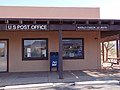 USPS - Marble Canyon, AZ 86036.jpg 4,608 × 3,456; 3.63 MB

.jpg)